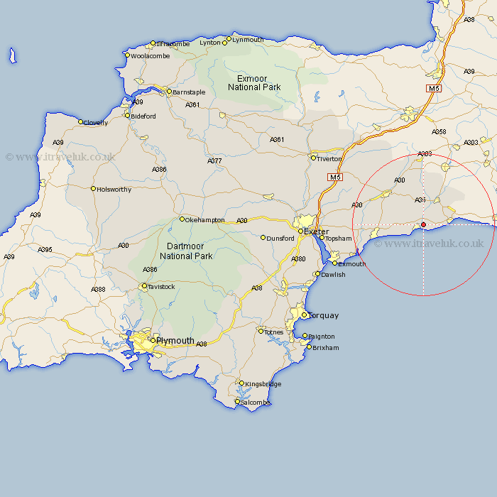
Devon Map Showing Location of Axmouth
Population: 493
District: East Devon
Easting: 325882 Northing: 91375
Latitude: 50.72 Longitude: -3.05
 = Axmouth
District: East Devon
Easting: 325882 Northing: 91375
Latitude: 50.72 Longitude: -3.05
= Axmouth
This Axmouth map below is supplied by Google. Use the tools in the top left corner to zoom into street level or zoom out for a road map, you may also need to zoom in to see Axmouth on the map. Click and drag the map to move around. If the map fails to load try and refresh your browser or zoom in or out (+ or -).
Update - it seems Google no longer allow people to use their maps for free! This Axmouth map sometimes loads and sometimes gives a error. I am working on a solution.
Closest 30 Towns or Cities to Axmouth (Population over 500)
Seaton 2.2km Musbury 3.88km Beer 3.98km Colyton 4.38km Kilmington 5.68km Shute 5.68km Uplyme 6.15km Branscombe 6.16km Axminster 8.77km Membury 11.36km Stockland 13.02km Honiton 13.18km Chardstock 13.79km Sidmouth 14.57km Gittisham 14.87km Ottery St Mary 15.69km Ottery St. Mary 15.69km Ottery Saint Mary 15.69km Yarcombe 16.72km Upottery 17.68km Newton Poppleford 17.7km Otterton 18.47km Colyton Raleigh 19.15km Colaton Raleigh 19.15km Payhembury 19.88km Broadhembury 20.01km Talaton 20.17km East Budleigh 20.2km Dunkeswell 20.38km Whimple 21.83km