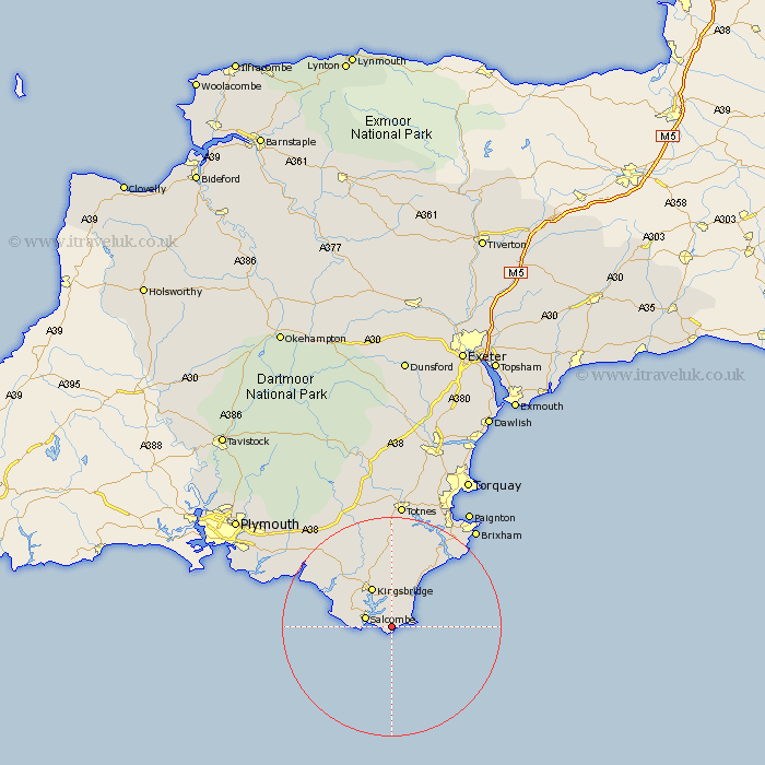
Devon Map Showing Location of West Prawle
District: South Hams
Easting: 277540 Northing: 36667
Latitude: 50.22 Longitude: -3.72
 = West Prawle
Easting: 277540 Northing: 36667
Latitude: 50.22 Longitude: -3.72
= West Prawle
This West Prawle map below is supplied by Google. Use the tools in the top left corner to zoom into street level or zoom out for a road map, you may also need to zoom in to see West Prawle on the map. Click and drag the map to move around. If the map fails to load try and refresh your browser or zoom in or out (+ or -).
Update - it seems Google no longer allow people to use their maps for free! This West Prawle map sometimes loads and sometimes gives a error. I am working on a solution.
Closest 30 Towns or Cities to West Prawle (Population over 500)
Salcombe 5.09km Malborough 6.21km Stokenham 6.6km Kingsbridge 8.21km West Alvington 9.03km East Allington 11.18km Thurlestone 12.03km Thurleston 12.03km Loddiswell 12.09km Aveton Gifford 12.43km Strete 12.6km Street 12.6km Stoke Fleming 13.87km Blackawton 15.24km Dartmouth 17.59km Kingswear 18.26km Modbury 18.97km Ugborough 20.81km Diptford 20.92km Holbeton 21.05km Stoke Gabriel 21.58km Ermington 21.91km Harberton 22.24km Totnes 23.24km Ivybridge 23.35km Yealmpton 24.06km Brixham 24.09km Berry Pomeroy 24.55km Newton Ferrers 25.1km South Brent 25.47km