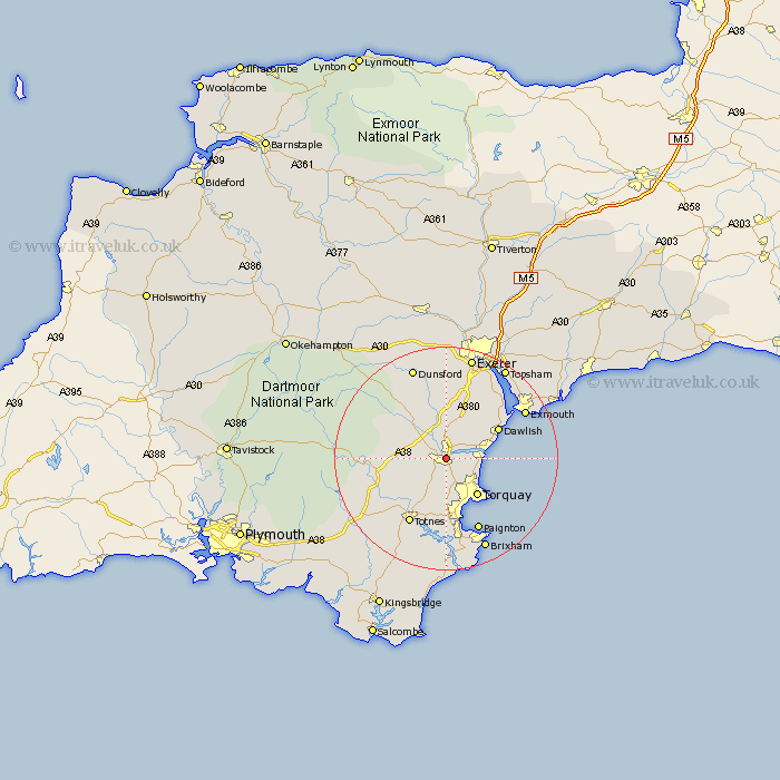
Devon Map Showing Location of Newton Abbot
Population: 23516
Area Size (ha): 607
District: Teignbridge
Easting: 286619 Northing: 71683
Latitude: 50.53 Longitude: -3.6
 = Newton Abbot
Area Size (ha): 607
District: Teignbridge
Easting: 286619 Northing: 71683
Latitude: 50.53 Longitude: -3.6
= Newton Abbot
This Newton Abbot map below is supplied by Google. Use the tools in the top left corner to zoom into street level or zoom out for a road map, you may also need to zoom in to see Newton Abbot on the map. Click and drag the map to move around. If the map fails to load try and refresh your browser or zoom in or out (+ or -).
Update - it seems Google no longer allow people to use their maps for free! This Newton Abbot map sometimes loads and sometimes gives a error. I am working on a solution.
Closest 30 Towns or Cities to Newton Abbot (Population over 500)
Kingsteignton 2.2km Abbotskerswell 3.89km Kingskerswell 3.89km Stokeinteignhead 5.06km Bishopsteignton 5.06km Denbury 5.12km Ipplepen 6.04km Marldon 7.41km Chudleigh 7.51km Bovey Tracey 8.1km Broadhempston 8.1km Hennock 8.78km Torquay 9.03km Teignmouth 9.6km Ilsington 10.12km Staverton 10.24km Ashburton 10.76km Dawlish 10.94km Berry Pomeroy 11.67km Lustleigh 12.4km Christow 13.44km Totnes 13.62km Starcross 14.08km Buckfastleigh 14.11km Kenton 14.57km Paignton 14.59km Widecombe in the Moor 14.61km Widdecombe 14.61km Stoke Gabriel 14.87km Harberton 15.37km