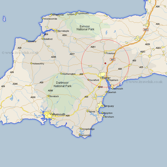
Devon Map Showing Location of Silverton
Population: 1195
Area Size (ha): 41
District: Mid Devon
Easting: 295517 Northing: 103013
Latitude: 50.82 Longitude: -3.48
 = Silverton
Area Size (ha): 41
District: Mid Devon
Easting: 295517 Northing: 103013
Latitude: 50.82 Longitude: -3.48
= Silverton
This Silverton map below is supplied by Google. Use the tools in the top left corner to zoom into street level or zoom out for a road map, you may also need to zoom in to see Silverton on the map. Click and drag the map to move around. If the map fails to load try and refresh your browser or zoom in or out (+ or -).
Update - it seems Google no longer allow people to use their maps for free! This Silverton map sometimes loads and sometimes gives a error. I am working on a solution.
Closest 30 Towns or Cities to Silverton (Population over 500)
Thorverton 3.97km Bradninch 5.03km Stoke Canon 5.68km Broad Clyst 6.58km Cullompton 8.07km Tiverton 9.27km Plymtree 9.37km Saint Cyres 9.91km Newton St. Cyres 9.91km St. Cyres 9.91km St Cyres 9.91km Newton St Cyres 9.91km Newton Saint Cyres 9.91km Cheriton Fitzpaine 10.07km Rockbeare 10.22km Halberton 10.38km Whimple 10.9km Willand 11.05km Crediton 12.28km Talaton 12.29km Whitestone 12.38km Sandford 12.88km Kentisbeare 12.96km Payhembury 13.02km Exeter 13.44km Aylesbeare 13.82km Uffculme 14.03km Sampford Peverell 14.23km Ide 14.24km Exminster 14.83km