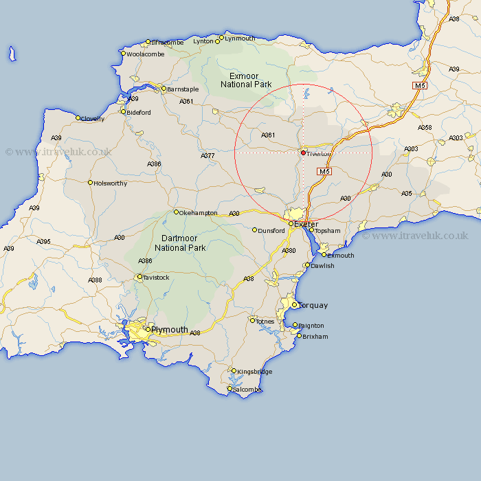
Devon Map Showing Location of Tiverton
Population: 14521
Area Size (ha): 408
District: Mid Devon
Easting: 295704 Northing: 112278
Latitude: 50.9 Longitude: -3.48
 = Tiverton
Area Size (ha): 408
District: Mid Devon
Easting: 295704 Northing: 112278
Latitude: 50.9 Longitude: -3.48
= Tiverton
This Tiverton map below is supplied by Google. Use the tools in the top left corner to zoom into street level or zoom out for a road map, you may also need to zoom in to see Tiverton on the map. Click and drag the map to move around. If the map fails to load try and refresh your browser or zoom in or out (+ or -).
Update - it seems Google no longer allow people to use their maps for free! This Tiverton map sometimes loads and sometimes gives a error. I am working on a solution.
Closest 30 Towns or Cities to Tiverton (Population over 500)
Halberton 4.67km Sampford Peverell 6.92km Cullompton 6.92km Willand 8.39km Bradninch 8.77km Bampton 9.26km Silverton 9.27km Uffculme 10.52km Cheriton Fitzpaine 10.88km Thorverton 11.66km Holcombe Rogus 11.93km Kentisbeare 12.26km Burlescombe 12.94km Plymtree 13.17km Stoke Canon 14.87km Broad Clyst 15.23km Sandford 15.86km Culmstock 16.46km Witheridge 16.47km Broadhembury 16.92km Saint Cyres 16.94km Newton Saint Cyres 16.94km Newton St. Cyres 16.94km Newton St Cyres 16.94km St Cyres 16.94km St. Cyres 16.94km Payhembury 17.01km Crediton 17.47km Talaton 17.47km Whimple 17.54km