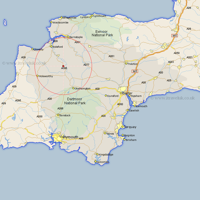
Devon Map Showing Location of Merton
Population: 331
District: Torridge
Easting: 252295 Northing: 111474
Latitude: 50.88 Longitude: -4.1
 = Merton
District: Torridge
Easting: 252295 Northing: 111474
Latitude: 50.88 Longitude: -4.1
= Merton
This Merton map below is supplied by Google. Use the tools in the top left corner to zoom into street level or zoom out for a road map, you may also need to zoom in to see Merton on the map. Click and drag the map to move around. If the map fails to load try and refresh your browser or zoom in or out (+ or -).
Update - it seems Google no longer allow people to use their maps for free! This Merton map sometimes loads and sometimes gives a error. I am working on a solution.
Closest 30 Towns or Cities to Merton (Population over 500)
Dolton 4.68km Hatherleigh 7.77km Langtree 7.94km Great Torrington 8.2km Torrington 8.2km Shebbear 8.99km Black Torrington 9.44km High Bickington 11.62km Burrington 11.9km Barrington 11.9km Northlew 13.02km Buckland Brewer 14.02km Sampford Courtnay 15.32km Sampford Courtney 15.32km Sampford Courtenay 15.32km Halwill 15.99km Chulmleigh 16.78km Parkham 16.81km North Tawton 16.82km Bideford 16.93km Okehampton 18.1km Chittlehampton 18.18km Northam 18.58km Chawleigh 18.8km Tawstock 18.86km Holsworthy 19.05km Instow 19.12km Appledore 19.81km Bradworthy 19.96km Fremington 20.43km