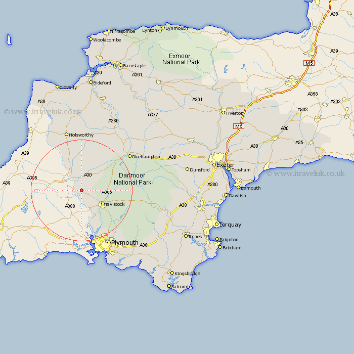
Devon Map Showing Location of Kelly
Population: 127
District: West Devon
Easting: 239608 Northing: 80326
Latitude: 50.6 Longitude: -4.27
 = Kelly
District: West Devon
Easting: 239608 Northing: 80326
Latitude: 50.6 Longitude: -4.27
= Kelly
This Kelly map below is supplied by Google. Use the tools in the top left corner to zoom into street level or zoom out for a road map, you may also need to zoom in to see Kelly on the map. Click and drag the map to move around. If the map fails to load try and refresh your browser or zoom in or out (+ or -).
Update - it seems Google no longer allow people to use their maps for free! This Kelly map sometimes loads and sometimes gives a error. I am working on a solution.
Closest 30 Towns or Cities to Kelly (Population over 500)
Milton Abbot 1.18km Lifton 3.88km Lamerton 6.95km Gunnislake 8.21km Broadwoodwidger 9.34km Tavistock 9.94km St. Giles 10.39km Saint Giles-on-the-Heath 10.39km St Giles-on-the-Heath 10.39km Saint Giles on the Heath 10.39km St. Giles on the Heath 10.39km Saint Giles 10.39km St. Giles-on-the-Heath 10.39km St Giles 10.39km St Giles on the Heath 10.39km Whitechurch 11.99km Whitchurch 11.99km Buckland Monachorum 14.57km Ashwater 14.87km Bridestowe 14.96km Horrabridge 16.2km Walkhampton 16.89km Yelverton 18.34km Halwill 18.68km Meavy 20.07km Northlew 21.34km Bickleigh 21.87km Shaugh Prior 22.65km Okehampton 23.94km Pyworthy 24.14km