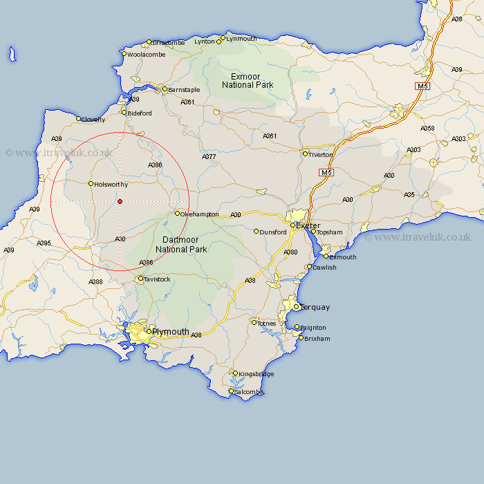
Devon Map Showing Location of Halwill
Population: 822
District: Torridge
Easting: 242526 Northing: 98786
Latitude: 50.77 Longitude: -4.23
 = Halwill
District: Torridge
Easting: 242526 Northing: 98786
Latitude: 50.77 Longitude: -4.23
= Halwill
This Halwill map below is supplied by Google. Use the tools in the top left corner to zoom into street level or zoom out for a road map, you may also need to zoom in to see Halwill on the map. Click and drag the map to move around. If the map fails to load try and refresh your browser or zoom in or out (+ or -).
Update - it seems Google no longer allow people to use their maps for free! This Halwill map sometimes loads and sometimes gives a error. I am working on a solution.
Closest 30 Towns or Cities to Halwill (Population over 500)
Ashwater 5.12km Black Torrington 6.58km Northlew 8.2km Shebbear 9.34km Broadwoodwidger 9.35km Holsworthy 9.91km St Giles-on-the-Heath 11.64km Saint Giles-on-the-Heath 11.64km St. Giles-on-the-Heath 11.64km St Giles on the Heath 11.64km St. Giles 11.64km Saint Giles 11.64km Saint Giles on the Heath 11.64km St Giles 11.64km St. Giles on the Heath 11.64km Pyworthy 12.29km Hatherleigh 12.97km Bridestowe 13.19km Bridgerule 14.54km Lifton 15.25km Okehampton 16.83km Langtree 16.84km Bradworthy 18.18km Milton Abbot 18.57km Dolton 19.12km Sampford Courtenay 20.01km Sampford Courtney 20.01km Sampford Courtnay 20.01km Torrington 21.21km Great Torrington 21.21km