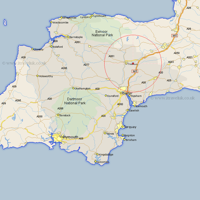
Devon Map Showing Location of Halberton
Population: 1573
District: Mid Devon
Easting: 300390 Northing: 112186
Latitude: 50.9 Longitude: -3.42
 = Halberton
District: Mid Devon
Easting: 300390 Northing: 112186
Latitude: 50.9 Longitude: -3.42
= Halberton
This Halberton map below is supplied by Google. Use the tools in the top left corner to zoom into street level or zoom out for a road map, you may also need to zoom in to see Halberton on the map. Click and drag the map to move around. If the map fails to load try and refresh your browser or zoom in or out (+ or -).
Update - it seems Google no longer allow people to use their maps for free! This Halberton map sometimes loads and sometimes gives a error. I am working on a solution.
Closest 30 Towns or Cities to Halberton (Population over 500)
Sampford Peverell 3.88km Cullompton 3.89km Willand 3.97km Tiverton 4.67km Uffculme 5.84km Bradninch 7.42km Kentisbeare 7.93km Holcombe Rogus 8.77km Burlescombe 8.95km Bampton 10.37km Plymtree 10.38km Silverton 10.38km Culmstock 11.83km Broadhembury 12.88km Hemyock 12.99km Thorverton 13.81km Payhembury 13.81km Dunkeswell 14.51km Talaton 14.75km Broad Clyst 14.87km Cheriton Fitzpaine 15.09km Whimple 15.55km Stoke Canon 15.94km Rockbeare 16.84km Gittisham 18.28km Newton St Cyres 19.63km St. Cyres 19.63km Saint Cyres 19.63km Newton St. Cyres 19.63km St Cyres 19.63km