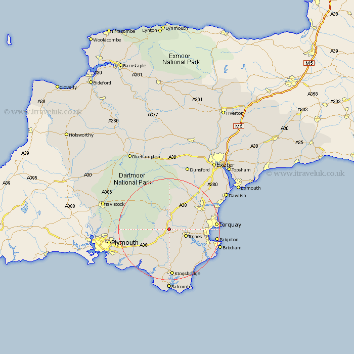
Devon Map Showing Location of Dean Prior
District: South Hams
Easting: 273406 Northing: 62715
Latitude: 50.45 Longitude: -3.78
 = Dean Prior
Easting: 273406 Northing: 62715
Latitude: 50.45 Longitude: -3.78
= Dean Prior
This Dean Prior map below is supplied by Google. Use the tools in the top left corner to zoom into street level or zoom out for a road map, you may also need to zoom in to see Dean Prior on the map. Click and drag the map to move around. If the map fails to load try and refresh your browser or zoom in or out (+ or -).
Update - it seems Google no longer allow people to use their maps for free! This Dean Prior map sometimes loads and sometimes gives a error. I am working on a solution.
Closest 30 Towns or Cities to Dean Prior (Population over 500)
Buckfastleigh 3.7km Brent 4km South Brent 4km Diptford 5.56km Harberton 6km Staverton 6.18km Totnes 7.17km Ashburton 7.78km Broadhempston 7.99km Ugborough 8.79km Berry Pomeroy 9.62km Denbury 10.95km Ipplepen 11.24km Ivybridge 12.01km Widecombe in the Moor 13.03km Widdecombe 13.03km Abbotskerswell 13.04km Stoke Gabriel 13.05km Marldon 13.11km Modbury 13.19km Ermington 13.23km Ilsington 13.45km Cornwood 13.5km Blackawton 13.86km Loddiswell 14.82km Kingskerswell 15.21km East Allington 15.24km Newton Abbot 15.94km Bovey Tracey 16.43km Aveton Gifford 17.05km