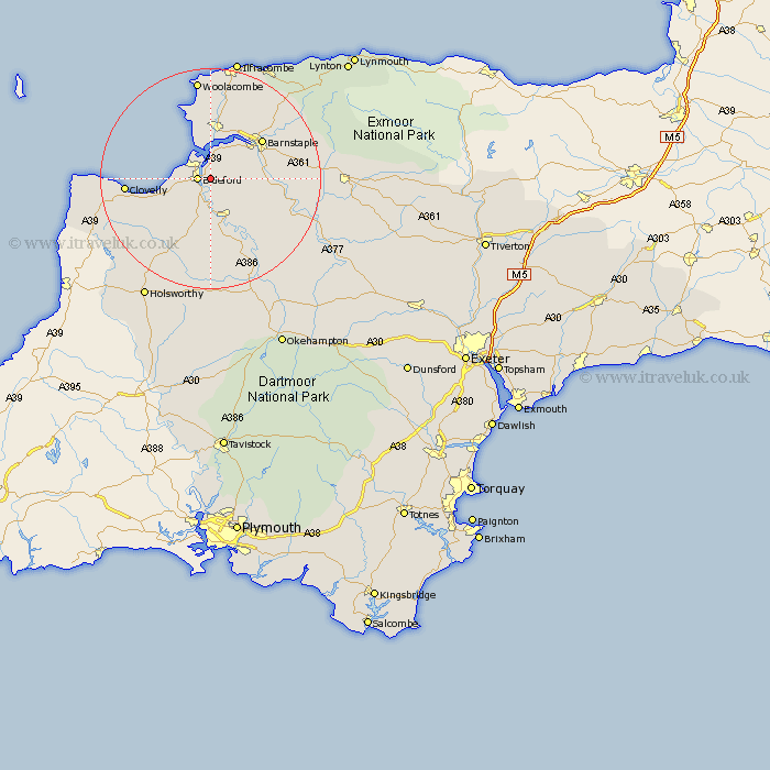
Devon Map Showing Location of Eastleigh
District: North Devon
Easting: 246873 Northing: 126471
Latitude: 51.02 Longitude: -4.18
 = Eastleigh
Easting: 246873 Northing: 126471
Latitude: 51.02 Longitude: -4.18
= Eastleigh
This Eastleigh map below is supplied by Google. Use the tools in the top left corner to zoom into street level or zoom out for a road map, you may also need to zoom in to see Eastleigh on the map. Click and drag the map to move around. If the map fails to load try and refresh your browser or zoom in or out (+ or -).
Update - it seems Google no longer allow people to use their maps for free! This Eastleigh map sometimes loads and sometimes gives a error. I am working on a solution.
Closest 30 Towns or Cities to Eastleigh (Population over 500)
Bideford 2.33km Northam 2.98km Appledore 3.89km Instow 3.89km Buckland Brewer 7.26km Fremington 7.26km Torrington 7.77km Great Torrington 7.77km Braunton 9.27km Parkham 9.88km Tawstock 10.03km Langtree 11.18km Barnstaple 11.91km Georgeham 13.02km Marwood 13.14km High Bickington 13.98km Woolfardisworthy 15.06km Woolsery 15.06km Swimbridge 15.6km Chittlehampton 16.32km West Down 17.32km Dolton 18.17km Mortehoe 18.57km Morthoe 18.57km Shebbear 18.68km Barrington 18.78km Burrington 18.78km Bradworthy 19.09km Bratton Fleming 19.74km Hartland 21.07km