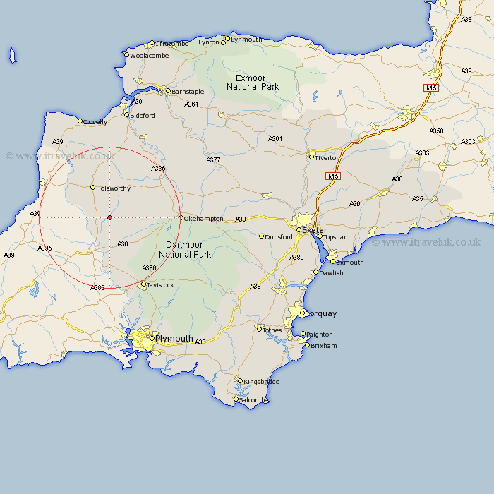
Devon Map Showing Location of Ashwater
Population: 651
District: Torridge
Easting: 238886 Northing: 95181
Latitude: 50.73 Longitude: -4.28
 = Ashwater
District: Torridge
Easting: 238886 Northing: 95181
Latitude: 50.73 Longitude: -4.28
= Ashwater
This Ashwater map below is supplied by Google. Use the tools in the top left corner to zoom into street level or zoom out for a road map, you may also need to zoom in to see Ashwater on the map. Click and drag the map to move around. If the map fails to load try and refresh your browser or zoom in or out (+ or -).
Update - it seems Google no longer allow people to use their maps for free! This Ashwater map sometimes loads and sometimes gives a error. I am working on a solution.
Closest 30 Towns or Cities to Ashwater (Population over 500)
Halwill 5.12km Broadwoodwidger 6.04km St. Giles on the Heath 6.58km Saint Giles-on-the-Heath 6.58km St. Giles 6.58km St Giles on the Heath 6.58km Saint Giles 6.58km Saint Giles on the Heath 6.58km St Giles 6.58km St. Giles-on-the-Heath 6.58km St Giles-on-the-Heath 6.58km Holsworthy 10.39km Pyworthy 11.06km Lifton 11.12km Black Torrington 11.64km Northlew 12.3km Bridgerule 12.9km Shebbear 13.8km Bridestowe 14.06km Milton Abbot 15.01km Hatherleigh 17.84km Lamerton 19.82km Bradworthy 19.82km Okehampton 19.94km Langtree 21.22km Tavistock 22.45km Gunnislake 22.73km Sampford Courtney 24.1km Sampford Courtnay 24.1km Sampford Courtenay 24.1km