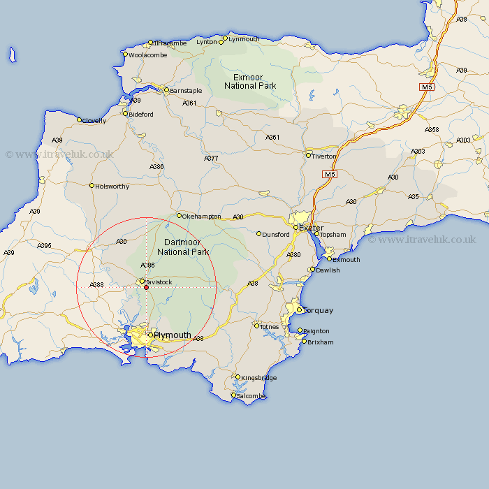
Devon Map Showing Location of Whitchurch
Population: 514
District: West Devon
Easting: 248829 Northing: 72630
Latitude: 50.53 Longitude: -4.13
 = Whitchurch
District: West Devon
Easting: 248829 Northing: 72630
Latitude: 50.53 Longitude: -4.13
= Whitchurch
This Whitchurch map below is supplied by Google. Use the tools in the top left corner to zoom into street level or zoom out for a road map, you may also need to zoom in to see Whitchurch on the map. Click and drag the map to move around. If the map fails to load try and refresh your browser or zoom in or out (+ or -).
Update - it seems Google no longer allow people to use their maps for free! This Whitchurch map sometimes loads and sometimes gives a error. I am working on a solution.
Closest 30 Towns or Cities to Whitchurch (Population over 500)
Tavistock 2.2km Buckland Monachorum 3.7km Horrabridge 4.39km Walkhampton 5.06km Lamerton 5.13km Gunnislake 5.89km Yelverton 6.59km Meavy 8.1km Bickleigh 10.39km Shaugh Prior 10.98km Milton Abbot 11.09km Plymouth 14.87km Lifton 15.36km Dartmoor Forest 16.28km Bridestowe 16.84km Cornwood 17.53km Broadwoodwidger 18.6km Brixton 21.58km St Giles on the Heath 21.85km St. Giles-on-the-Heath 21.85km St Giles-on-the-Heath 21.85km St. Giles 21.85km St. Giles on the Heath 21.85km Saint Giles 21.85km St Giles 21.85km Saint Giles-on-the-Heath 21.85km Saint Giles on the Heath 21.85km Ivybridge 22.66km Yealmpton 22.98km Widecombe in the Moor 23.84km