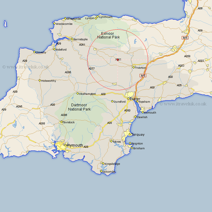
Devon Map Showing Location of Rackenford
Population: 335
District: North Devon
Easting: 285280 Northing: 118060
Latitude: 50.95 Longitude: -3.63
 = Rackenford
District: North Devon
Easting: 285280 Northing: 118060
Latitude: 50.95 Longitude: -3.63
= Rackenford
This Rackenford map below is supplied by Google. Use the tools in the top left corner to zoom into street level or zoom out for a road map, you may also need to zoom in to see Rackenford on the map. Click and drag the map to move around. If the map fails to load try and refresh your browser or zoom in or out (+ or -).
Update - it seems Google no longer allow people to use their maps for free! This Rackenford map sometimes loads and sometimes gives a error. I am working on a solution.
Closest 30 Towns or Cities to Rackenford (Population over 500)
Witheridge 6.92km Bampton 11.14km Cheriton Fitzpaine 11.18km Tiverton 11.89km Morchard Bishop 13.8km Lapford 14.91km Sandford 15.01km Chawleigh 15.08km South Molton 15.84km North Molton 16.11km Halberton 16.17km Sampford Peverell 16.45km Chulmleigh 16.77km Thorverton 18.09km Silverton 18.18km Crediton 18.57km Copplestone 18.58km Cullompton 18.8km Holcombe Rogus 19.93km Bradninch 19.98km Willand 20.11km Newton St Cyres 20.52km Newton St. Cyres 20.52km St. Cyres 20.52km Saint Cyres 20.52km Newton Saint Cyres 20.52km St Cyres 20.52km Nymet Tracey 21.06km Bow 21.06km Uffculme 21.75km