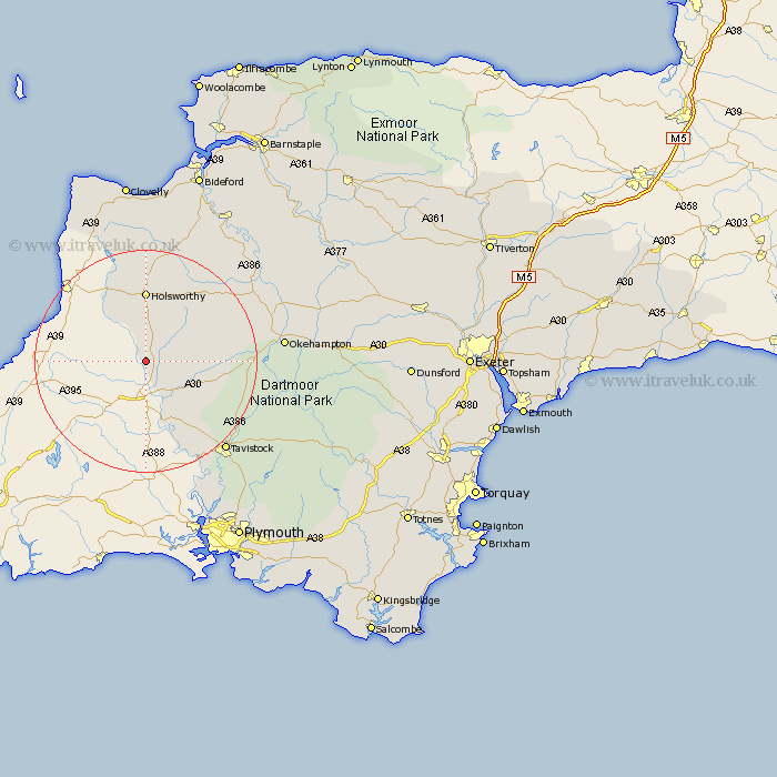
Devon Map Showing Location of Northcott
Population: 26
District: Torridge
Easting: 234065 Northing: 91626
Latitude: 50.7 Longitude: -4.35
 = Northcott
District: Torridge
Easting: 234065 Northing: 91626
Latitude: 50.7 Longitude: -4.35
= Northcott
This Northcott map below is supplied by Google. Use the tools in the top left corner to zoom into street level or zoom out for a road map, you may also need to zoom in to see Northcott on the map. Click and drag the map to move around. If the map fails to load try and refresh your browser or zoom in or out (+ or -).
Update - it seems Google no longer allow people to use their maps for free! This Northcott map sometimes loads and sometimes gives a error. I am working on a solution.
Closest 30 Towns or Cities to Northcott (Population over 500)
St. Giles 2.2km St. Giles on the Heath 2.2km Saint Giles-on-the-Heath 2.2km Saint Giles on the Heath 2.2km Saint Giles 2.2km St Giles on the Heath 2.2km St Giles 2.2km St. Giles-on-the-Heath 2.2km St Giles-on-the-Heath 2.2km Ashwater 5.98km Broadwoodwidger 7.28km Lifton 8.78km Halwill 11.06km Pyworthy 11.66km Bridgerule 12.57km Holsworthy 12.97km Milton Abbot 13.17km Black Torrington 17.49km Bridestowe 17.71km Northlew 18.02km Lamerton 18.92km Shebbear 19.13km Gunnislake 20.79km Tavistock 21.85km Bradworthy 22.36km Hatherleigh 23.78km Whitchurch 24.03km Whitechurch 24.03km Okehampton 24.92km Langtree 26.3km