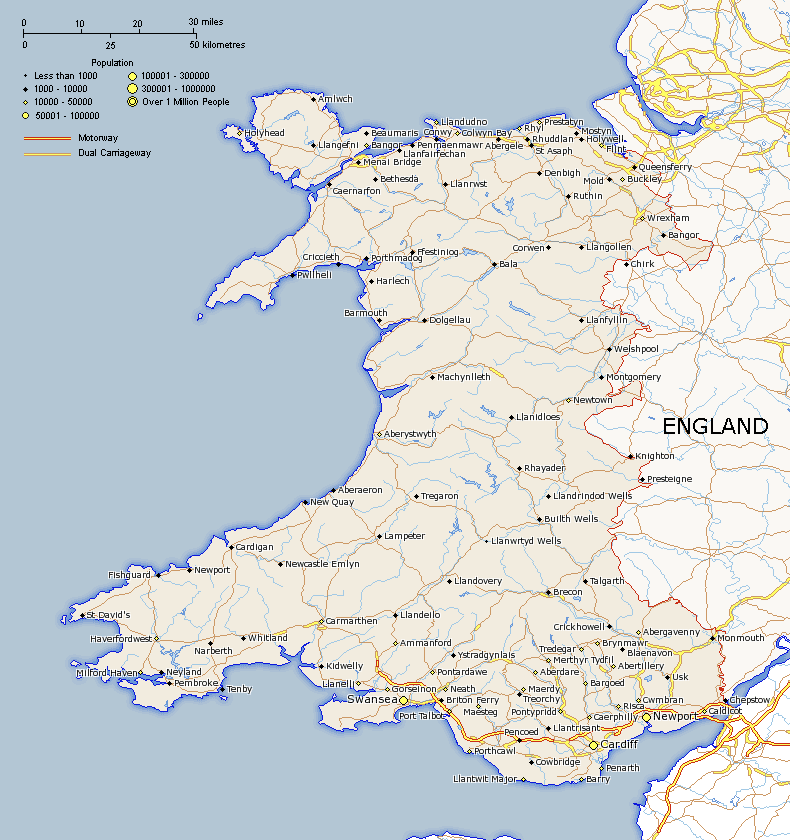
Wales Map
Map showing major roads, cites and towns. This map can be used for offline use such as school or university projects or just for personal reference. It is made using latatute and longitude points provided from a variety of sources so it should be an accurate representation. Wales map provided by www.itraveluk.uk if you need to provide a reference.

About Wales
Wales is a country that is part of the United Kingdom and also Great Britian (United Kingdom minus Northern Ireland). It shares it's only land border to the east with England. It makes up 20,779 km sq (8,023 sq mi) out of 243,305 sq km that makes up the United Kingdom. Wales has a diverse landscape and is particularly mountainous in the central and northern areas. It has a maritime climate that is very changable.