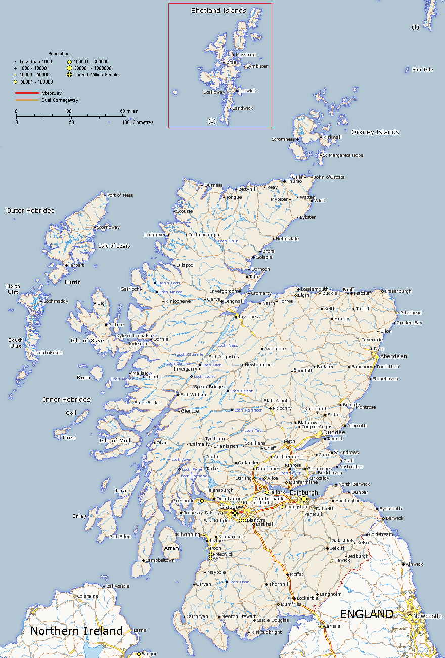
Map of Scotland
Scotland map showing major roads, cites and towns. This map is an accurate representation as it is made using latatute and longitude points provided from a variety of sources. This map can be used for offline use such as school or university projects or just for personal reference. Scotland map provided by www.itraveluk.uk if you need to provide a reference.
I have almost completed my large map of Scotland and I should have it up shortly.

About Scotland
Scotland is the most northern country in the United Kingdom. It's only land border is with England to the South. It makes up 78,772 sq km (30,414 sq mi) out of 243,305 sq km that makes up the UK. The geography of Scotland is considerably different than England. It has many mountainous areas such as the Cairngorms and the Nothwest Highlands. These mountainous areas are interspersed with numourous lakes (lochs) and valleys (glens). The majority of the population live in the lower half of the country where you will find the largest cities Edinburgh (the capital) and the vibrant city of Glasgow.