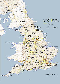
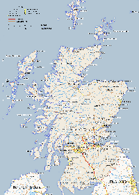
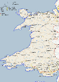
Maps /

Maps of The United Kingdom and Ireland.

Maps of The United Kingdom and the Republic of Ireland

Map showing major cities and towns within the United Kingdom and the Rebublic or Ireland. The United Kingdom comprises or England, Wales, Scotland and Norther Ireland. The UK it is also called the "Home Countries". Britain comprises of England, Wales and Scotland. Although this site is is mainly about The United Kingdom, I have included the Rebublic of Ireland in the Ireland map. All these maps are a accurate representation of each country as they are made using latatute and longitude points provided from a variety of sources. The maps are made with PHP and it's GD graphics library and made a bit more pretty in photoshop if anyone is interested. They are all copyright www.itraveluk.co.uk and cannot be used on anyother website at all. They can be used for offline use such as school or university projects or just for personal reference. Map provided by www.itraveluk.uk if you need to provide a reference. No need to ask me as long as it is staying offline.


United Kingdom Map

Map of the United Kingdom and Ireland

About The United Kingdom

The United Kingdom lies off the north western coast of mainland Europe. It is a soverign state with a total area of about 248,500 square kilometres or 95,900 square miles.

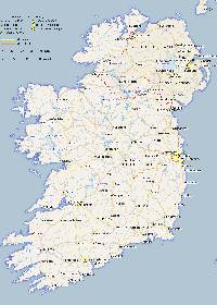
The United Kingdom is between the North Sea and the North Atlantic. It is within 35 km (22 mi) of the north western coast of France and is separated by the English Channel. It shares a 499 km border with the Republic of Ireland (Eire) which is not apart of the United Kingdom.

The geography of the United Kingdom is quite varied. England is mostly lowland terrain, with some mountainous terrain found in the north west. Upland areas include the Pennines, North York Moors, the Lake District, Dartmoor and Exmoor. Scotland is more mountainous than the other countries in the UK. The Highlands are predominantly mountainous, containing the majority of Scotland's mountainous landscape. Like Scotland Wales is also mostly mountainous although less so in the south of Wales. Northern Ireland is mostly hilly and its geography includes Lough Neagh which at 388 square kilometres (150 sq mi) makes it the largest body of water in the United Kingdom.

The following are more detailed maps of each of the countries in the United Kingdom. You will also find county maps for England and location maps for over 10 thousand cities, towns and villiages. I have only done this for England and Scotland for now.

England Map

Click on the link map to see a larger Map of England. Includes major roads and towns.

Scotland Map

Click on the link map to see a larger Map of Scotland. Includes major roads, towns and outlying island.

Wales Map

Click on the link map to see a larger Map of Wales. Includes major roads and towns.

Ireland

Click on the link map to see a larger Map of Wales. Map includes both Norther and The Rebublic of Ireland and includes major roads and towns.