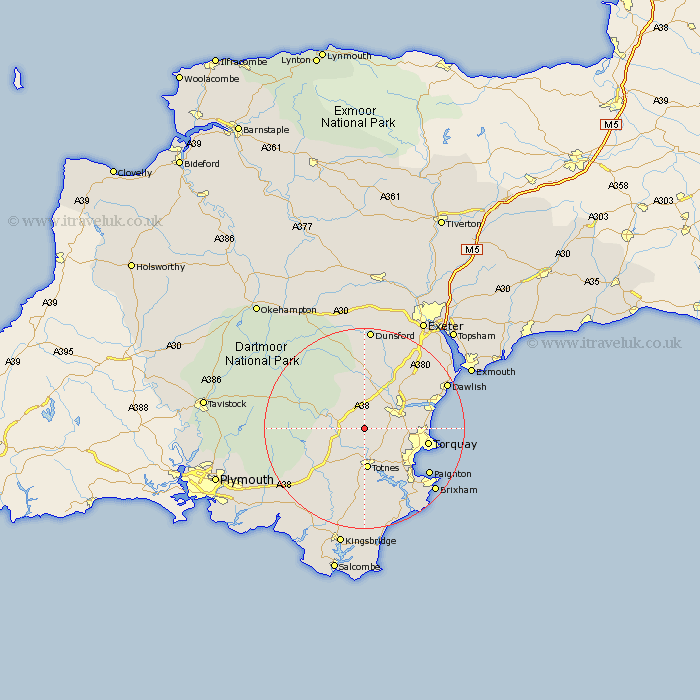
Devon Map Showing Location of Woodland
Population: 134
District: Teignbridge
Easting: 279449 Northing: 68135
Latitude: 50.5 Longitude: -3.7
 = Woodland
District: Teignbridge
Easting: 279449 Northing: 68135
Latitude: 50.5 Longitude: -3.7
= Woodland
This Woodland map below is supplied by Google. Use the tools in the top left corner to zoom into street level or zoom out for a road map, you may also need to zoom in to see Woodland on the map. Click and drag the map to move around. If the map fails to load try and refresh your browser or zoom in or out (+ or -).
Update - it seems Google no longer allow people to use their maps for free! This Woodland map sometimes loads and sometimes gives a error. I am working on a solution.
Closest 30 Towns or Cities to Woodland (Population over 500)
Broadhempston 2.2km Denbury 3.54km Staverton 3.7km Ashburton 3.99km Ipplepen 5.07km Abbotskerswell 5.89km Buckfastleigh 6.18km Ilsington 7.78km Newton Abbot 7.98km Marldon 7.99km Berry Pomeroy 8.22km Kingskerswell 8.25km Totnes 8.37km Harberton 9.34km Bovey Tracey 9.34km Kingsteignton 9.95km Widecombe in the Moor 10.25km Widdecombe 10.25km Hennock 11.37km Stokeinteignhead 11.93km South Brent 12km Brent 12km Stoke Gabriel 12.59km Diptford 12.59km Bishopsteignton 13.03km Lustleigh 13.03km Torquay 13.16km Chudleigh 13.84km Paignton 16.17km Ugborough 16.77km