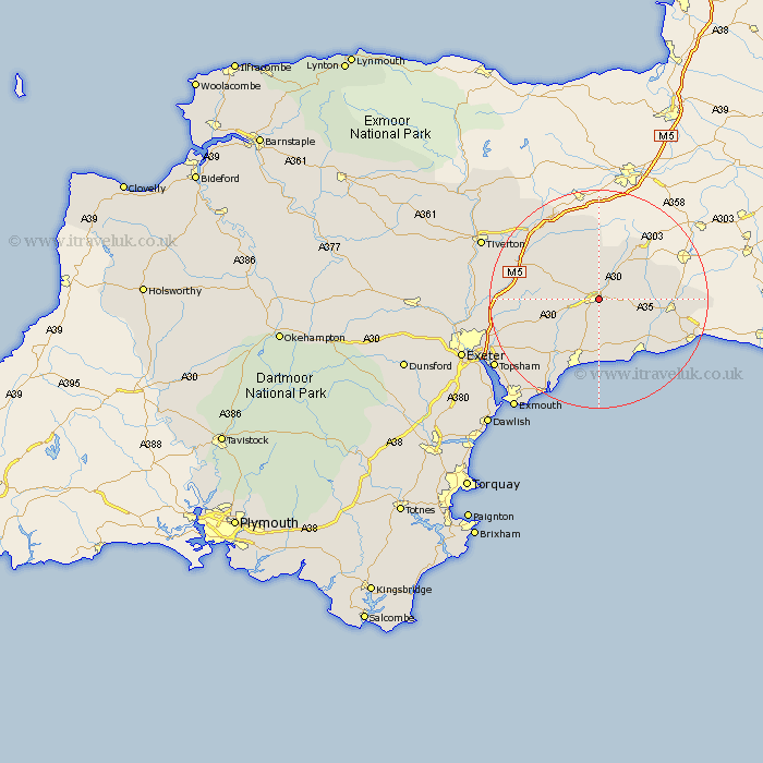
Devon Map Showing Location of Honiton
Population: 7712
Area Size (ha): 236
District: East Devon
Easting: 316618 Northing: 100778
Latitude: 50.8 Longitude: -3.18
 = Honiton
Area Size (ha): 236
District: East Devon
Easting: 316618 Northing: 100778
Latitude: 50.8 Longitude: -3.18
= Honiton
This Honiton map below is supplied by Google. Use the tools in the top left corner to zoom into street level or zoom out for a road map, you may also need to zoom in to see Honiton on the map. Click and drag the map to move around. If the map fails to load try and refresh your browser or zoom in or out (+ or -).
Update - it seems Google no longer allow people to use their maps for free! This Honiton map sometimes loads and sometimes gives a error. I am working on a solution.
Closest 30 Towns or Cities to Honiton (Population over 500)
Gittisham 3.97km Broadhembury 6.93km Dunkeswell 7.78km Ottery St. Mary 8.08km Ottery St Mary 8.08km Ottery Saint Mary 8.08km Payhembury 8.2km Upottery 8.21km Colyton 8.96km Stockland 9km Shute 9km Talaton 9.55km Yarcombe 11.05km Kilmington 11.18km Branscombe 11.66km Plymtree 11.86km Membury 11.86km Musbury 11.92km Kentisbeare 11.95km Whimple 12.29km Beer 12.57km Hemyock 13.44km Sidmouth 13.79km Culmstock 13.79km Seaton 13.82km Newton Poppleford 13.82km Axminster 14.18km Chardstock 14.53km Rockbeare 15.12km Uffculme 15.31km