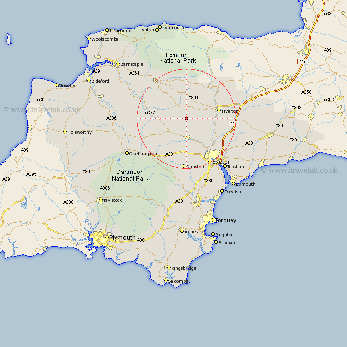
Devon Map Showing Location of Woolfardisworthy
Population: 166
District: Mid Devon
Easting: 282730 Northing: 108851
Latitude: 50.87 Longitude: -3.67
 = Woolfardisworthy
District: Mid Devon
Easting: 282730 Northing: 108851
Latitude: 50.87 Longitude: -3.67
= Woolfardisworthy
This Woolfardisworthy map below is supplied by Google. Use the tools in the top left corner to zoom into street level or zoom out for a road map, you may also need to zoom in to see Woolfardisworthy on the map. Click and drag the map to move around. If the map fails to load try and refresh your browser or zoom in or out (+ or -).
Update - it seems Google no longer allow people to use their maps for free! This Woolfardisworthy map sometimes loads and sometimes gives a error. I am working on a solution.
Closest 30 Towns or Cities to Woolfardisworthy (Population over 500)
Cheriton Fitzpaine 3.97km Sandford 5.56km Morchard Bishop 6.14km Witheridge 6.57km Crediton 9.34km Lapford 9.36km Copplestone 9.45km Thorverton 11.95km Saint Cyres 12.07km St. Cyres 12.07km Newton St. Cyres 12.07km St Cyres 12.07km Newton St Cyres 12.07km Newton Saint Cyres 12.07km Chawleigh 12.26km Bow 12.88km Nymet Tracey 12.88km Tiverton 13.38km Silverton 14.02km Tedburn Saint Mary 14.88km Tedburn St. Mary 14.88km Tedburn St Mary 14.88km Chulmleigh 15.09km Whitestone 15.56km Cheriton Bishop 15.56km Stoke Canon 16.15km Holcombe Burnell 16.84km Halberton 17.92km Bradninch 17.94km North Tawton 17.99km