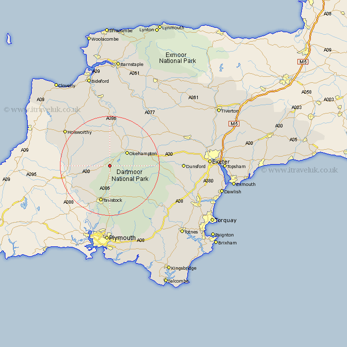
Devon Map Showing Location of Bridestowe
Population: 552
District: West Devon
Easting: 251663 Northing: 89239
Latitude: 50.68 Longitude: -4.1
 = Bridestowe
District: West Devon
Easting: 251663 Northing: 89239
Latitude: 50.68 Longitude: -4.1
= Bridestowe
This Bridestowe map below is supplied by Google. Use the tools in the top left corner to zoom into street level or zoom out for a road map, you may also need to zoom in to see Bridestowe on the map. Click and drag the map to move around. If the map fails to load try and refresh your browser or zoom in or out (+ or -).
Update - it seems Google no longer allow people to use their maps for free! This Bridestowe map sometimes loads and sometimes gives a error. I am working on a solution.
Closest 30 Towns or Cities to Bridestowe (Population over 500)
Okehampton 8.97km Northlew 9.35km Broadwoodwidger 10.57km Halwill 13.19km Ashwater 14.06km Milton Abbot 14.06km Lifton 14.07km Lamerton 14.23km Hatherleigh 15.02km South Tawton 15.14km Tavistock 15.24km Sampford Courtenay 15.33km Sampford Courtnay 15.33km Sampford Courtney 15.33km Black Torrington 15.95km Saint Giles on the Heath 16.44km St Giles on the Heath 16.44km St Giles 16.44km Saint Giles 16.44km Saint Giles-on-the-Heath 16.44km St. Giles 16.44km St. Giles on the Heath 16.44km St. Giles-on-the-Heath 16.44km St Giles-on-the-Heath 16.44km Whitchurch 16.84km Whitechurch 16.84km Dartmoor Forest 17.05km Gunnislake 18.6km Walkhampton 18.67km Chagford 18.79km